Context
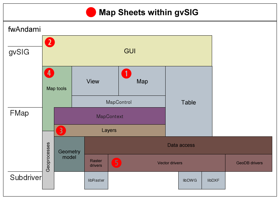
This very simple diagram shows the basics of the gvSIG 1.X architecture. Red circled numbers indicate -in order of relevance- the parts where the Map Sheets extension adds a new component:
(1) A new type of map document is added which allows the management of active fields refreshed with the geometry and attributes from a certain feature. Also adds special types of frames (for view and texts)
(2) Adds new menu 'View > Map Sheets' and 'Map > Map Sheets' and plenty of dialogs following the fwAndami framework. The most relevant dialog is the one that allows the user to browse different maps by selecting the desired feature ID.
(3) Adds a new type of vector layer (a grid) consisting of a set of rectangles and certain attriburtes.
(4) It also adds a map tool to easily adjust the frames in the map sheet grid.
(5) A new in-memory vector driver is added since the grid is kept in memory during the gvSIG session.


