


Document Actions
gvSIG-Desktop 1.9. User manual
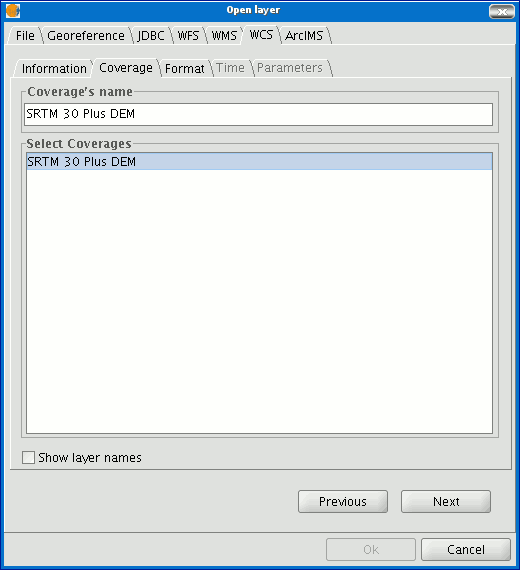
Manual usuario gvSIG-1.9 - Visualización y acceso a datos - Loading data - Geografic data - Raster - Adding a layer using WCS protocol - Selecting 'Coverages'
Select the coverage you wish to add to your gvSIG view. If you wish, you can choose a name for your layer in the “Coverage name” field.
Cached time 11/21/13 07:17:22 


